


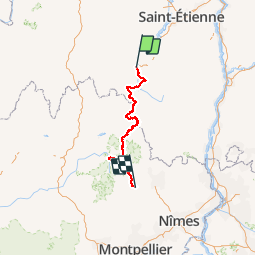
Chemin de Stevenson

phimar_2612
User

Length
245 km

Max alt
1699 m

Uphill gradient
7194 m
Km-Effort
342 km

Min alt
185 m

Downhill gradient
7628 m
Boucle
No
Creation date :
2018-04-16 16:58:36.147
Updated on :
2018-04-16 16:58:36.147
61h13
Difficulty : Difficult

FREE GPS app for hiking
 SityTrail
IGN / Geographical institutes
SityTrail Plus
The world is yours!
About
Trail Walking of 245 km to be discovered at Auvergne-Rhône-Alpes, Haute-Loire, Le Puy-en-Velay. This trail is proposed by phimar_2612.
Description
GR70 du Puy en Velay à Saint Jean du Gard
Positioning
Country:
France
Region :
Auvergne-Rhône-Alpes
Department/Province :
Haute-Loire
Municipality :
Le Puy-en-Velay
Location:
Unknown
Start:(Dec)
Start:(UTM)
569976 ; 4987904 (31T) N.
Comments